Posted by: dave c
at 00:00, June 11 2010.
Charlie, Ginni and I made yet another pilgrimage to climb more remote and obscure peaks in Death Valley National Park. As always, the climbs were interesting, often long and involving complex route-finding. There are no trails on these peaks so a typical day consisted of driving to a starting point based on GPS coordinates, then heading cross country over the seemingly endless alluvial fans, before reaching the peak proper. From that point it required choosing an appropriate ridge to climb to gain the summit. Sometimes this was based on a pre-determined set of GPS waypoints that Charlie had painstakingly planned ahead of time, sometimes we needed to modify the route based on what we found. Again, we climbed both limestone peaks, with the razor sharp rock features that required leather gloves, as well as peaks composed largely of volcanic rock. Climbing difficulty ranged from Class 2 to Class 4 scrambling.
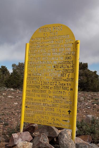
As usual, the crux of the day was often the driving approach, on some of the rough 4WD roads in the Park. The first day had one of these, with much driving and a relatively short hike to climb Park BM (Benchmark). After driving to Ballarat we took the rough road to Rogers Pass, then continued on to the trailhead for Park.
The rough road to Rogers Pass
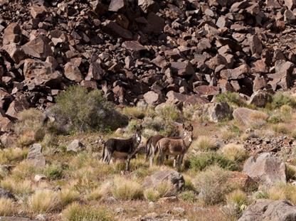
Rogers Pass Wild Burros
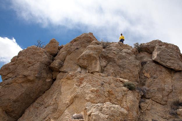
Charlie on the summit of Park Benchmark. The final scrambling pitch is directly below him
The next day we drove via Crankshaft Junction to the Saline Valley Road in the remote, northern part of the Park. We spent the next several days climbing Eureka Peak and Zinc BM and Crest BM. This was quite an adventure, requiring several rough drives which took their toll on Charlie’s vehicle. A tree root put a large hole in the sidewall of one of the tires, luckily right at the end of this segment of the trip. Eureka Peak was another especially long day – 16 miles and 4200 feet of elevation gain.
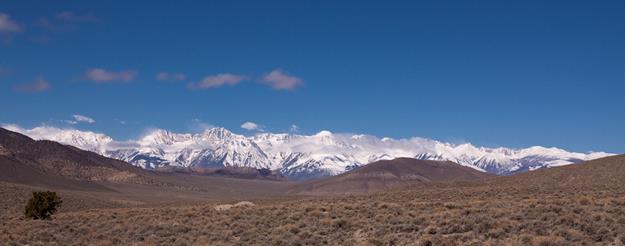
Sierra view from the Saline Valley Road
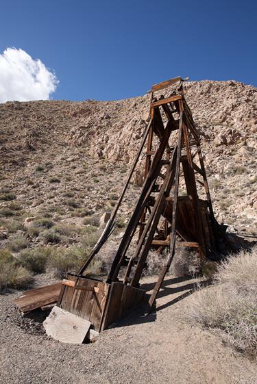
Mineshaft near our backcountry campsite Crankshaft Junction
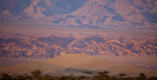
Charlie on the summit of Eureka Peak Eureka Dunes from the summit of
Eureka Peak
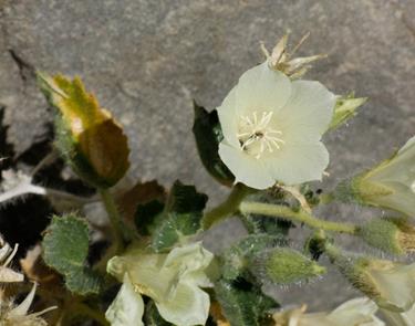
Desert Poppy? Sidewall puncture
Changing the tire, far from civilization. A good reason to have 2 vehicles along.
We needed to get a new tire, so the next day was spent in Bishop, one of the more scenic towns I’ve visited.
Downtown Bishop
Then it was back to climbing.
After a night camped at Mesquite CG we headed towards Teakettle Junction. We had been dreading the drive to Teakettle Junction on the notorious Racetrack Road, but it turned out that it had been recently graded – a pleasant surprise. While Ginni and Charlie went off to climb Gold BM, I headed to the famous Racetrack, where I started the day climbing the “Grandstand”, a small rock feature protruding from the Racetrack. The last few feet to the highest point on the Grandstand is quite interesting, requiring some climbing skills, especially for the downclimb. Then I spent the rest of the day wandering around the Racetrack area photographing the famed “Moving Rocks”.
The Racetrack and Grandstand Teakettle Junction
The Grandstand The Racetrack
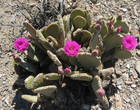
Flowers lining the edge of the Racetrack
Moving Rocks
I was also lucky enough to see three American Avocets along the edge of the Racetrack.
Our last day of climbing was another big one – about 16 miles and 5,000 feet of elevation gain. Our goal was to climb Cameo BM and Warm BM. Routefinding was quite involved on this day, but the effort was well worth it. Not only did we climb two fine peaks with some excellent scrambling, but the wildflowers bloomed this day that the temperature exceeded 100 degrees at Furnace Creek. The hot weather also brought out the rattlesnakes!
Early morning hiking Rattlesnake
One interesting find was the scattered remains of an aircraft, reputedly an F-16, between the two peaks.
Airplane wreckage Taking a water break on the way
down, Warm BM in the background
Wildflowers
Lead Mine
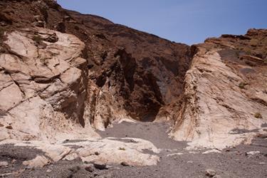
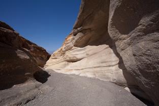
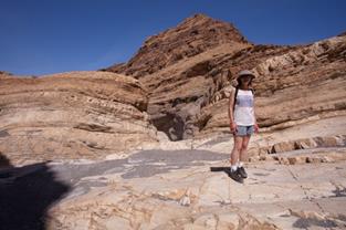
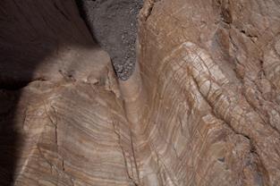
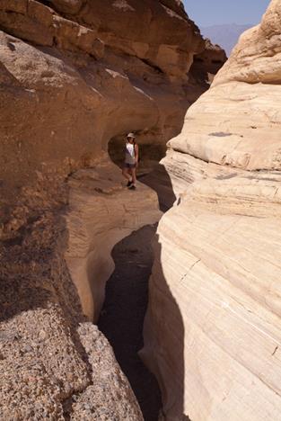
Now it was time for Ginni and I to play tourist. We spent several hours exploring Mosaic Canyon, an easy hike with spectacular rock formations.
The Death Valley Pupfish are uniquely adapted for life in the highly saline Salt Creek.
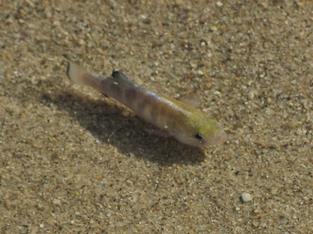
Pupfish in Salt Creek
Back to the Mesquite Dunes for sunset.
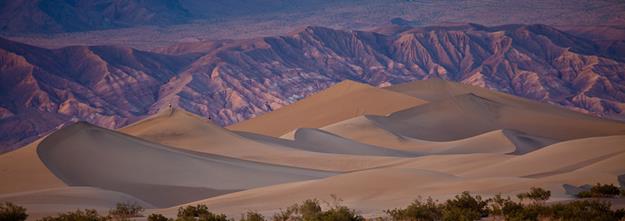
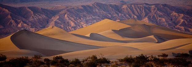
Mesquite Dunes
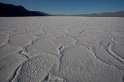
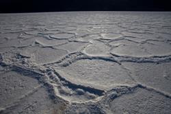
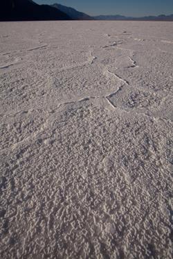
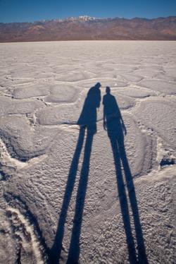
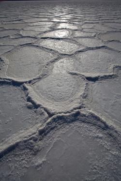
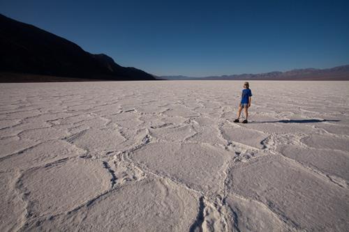
After spending a night camped at Furnace Creek, we headed to Badwater for sunrise. The lowest point in the Western Hemisphere, there is a permanent spring and an intermittent salt lake. Crystallized salt forms interesting patterns as the water of the lake evaporates.
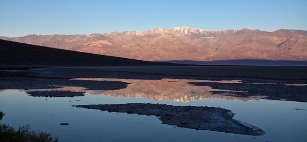
Telescope Peak reflected in the pools at Badwater
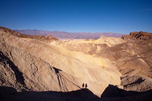
A quick visit to Zabriskie Point and we headed home after another excellent visit to Death Valley.